
Fishing and Floating the Merced River
The Merced is our local river and it can be a great place to fish or float. Because access points aren’t well publicized, this page is an attempt to provide some information about them.
Starting in the high country of Yosemite National Park, the river flows westward for 145 miles before joining the San Joaquin near the town of Newman. The following is a list of access points in Merced County starting at the western end of the river and working east towards Mariposa County.
Safety:
Fishing is generally a safe river recreation as long as you do not wade out into the river.Swimming, boating, and floating the river on rafts or tubes are more hazardous activities.They are not recommended except in designated swimming sites such as the Hatfield and McConnell State Recreation Areas.Do not venture out into the river unless you are a strong swimmer, you wear a life jacket, you are sober, and you have a first aid kit and plenty of emergency supplies.
If you’ve never floated a river before, find someone experienced to go with.
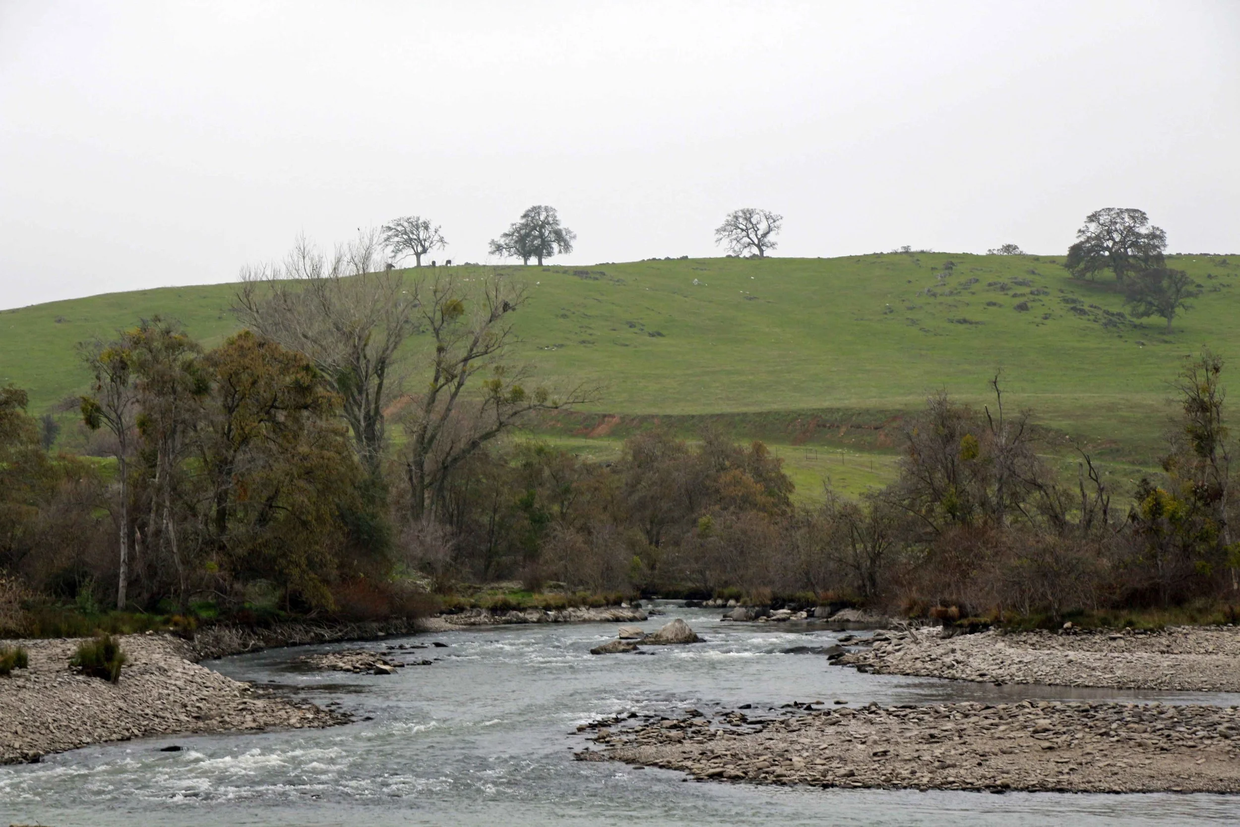
The river has several rapids and places where rafters and boaters may be swept into trees and vines.There are also places where the river splits into multiple channels and it can be difficult to choose the safest route.High water flow, especially in the spring and after storms, may make the river extremely dangerous.Mid to late summer is usually the safest time to go, but this is not always the case.
Rivers have dangerous underwater hazards that can snare and drown swimmers and boaters.Every year California’s rivers claim lives!Think carefully before getting in the river and observe any posted safety warnings.
Some of the best online information about floating the river can be found at:https://www.americanwhitewater.org/content/River/detail/id/5042/.
Access Points:
George J. Hatfield State Recreation Area: Located near the river’s confluence with the San Joaquin, this state park offers the last access point to the river.Camping, picnicking, fishing, wading, and swimming are all permitted.Located at 4394 North Kelly Road which is technically in the town of Hilmar, the closest population center and supplies is actually Newman.

Photo by Adam Blauert
For more information go to http://www.parks.ca.gov/?page_id=556.
A brochure that covers both Hatfield and McConnell State Recreation Areas can be downloaded at:
http://www.parks.ca.gov/pages/554/files/McConnellHatfield.pdf
You can also call the park office at (209) 826-1197 for more information.
Hagaman Park/Highway 165:
The signs posted by Merced County at Hagaman Park tell visitors that they should stay out of the river, but the brochure produced by California State Parks to provide information about its two parks along the river (Hatfield and McConnell) lists it as one of the places you can take your raft or canoe out of the river if you are floating it.
The result is confusion.I don’t recommend Hagaman Park as a place to access the river, but if you are interested in doing so, contact Merced County Parks and Recreation first: (209) 385-7426.

Photo by Adam Blauert
You can also find park information at http://www.co.merced.ca.us/index.aspx?NID=1410.
Hagaman Park is located at the intersection of Highway 165 (Lander Avenue) and River Road.Highway 165 crosses the river and all potential access points near the highway are marked “No Trespassing.”
McConnell State Recreation Area:
This state park offers camping, picnicking, and some of the best access for fishing, wading, and swimming on the lower river.Located off El Capitan Way at the end of McConnell Road, the closest population centers and supplies are Delhi and Livingston.
For more information, go to http://www.parks.ca.gov/?page_id=554.
A brochure that covers both McConnell and Hatfield State Recreation Areas can be downloaded at:
http://www.parks.ca.gov/pages/554/files/McConnellHatfield.pdf
You can also call the park office at (209) 394-7755 for more information.
Bridges:
Highway 99 Bridge:All potential access points along the highway are marked “No Trespassing.”
Santa Fe Avenue Bridge: Like Highway 99, all potential access points along the highway are marked “No Trespassing.”
Oakdale Road Bridge:There’s plenty of parking near the bridge and you can walk across the original 1912 bridge (now only open to foot and bike traffic), but the potential river access points are signed “No Trespassing.”It’s clear that some people do access the river here, but you’re liable to citation for trespassing if you do.
Highway 59 Bridge: Although official signs at this location delineate the fishing regulations for this part of the river, the landowner has informed me that any access at this point will be considered trespassing. Don’t access the river at this location."
Snelling Road Bridge:Like the Highway 59 Bridge, land on both sides is private, but access has been allowed from the corridor along the highway.If you access the river here, be aware of all posted signs which may limit access in the future.The bridge is located on Snelling Road, 0.7 miles south of the junction with Highway 59.
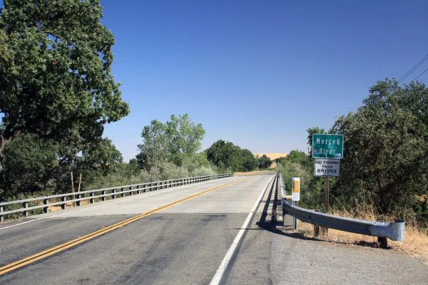
Photo by Adam Blauert
Snelling:
I’ve talked to a lot of people who have fished the river at the end of 3rd Street in Snelling, but there are currently “No Trespassing” signs posted.If you visit, check the signs before you access the river.
This area is accessed by turning south on 3rd Street (near the Chevron gas station) and following the road for a short distance.It becomes a rough dirt road near the river.

Photo by Adam Blauert
Henderson Park:
This county park is located 1 mile east of downtown Snelling on Merced Falls Road.It offers picnic areas, playgrounds, and plenty of river access.Signs warn visitors about the dangers of river access, but do not prohibit it.

Photo by Adam Blauert
For more information go to http://www.co.merced.ca.us/index.aspx?NID=1454
or call (209) 385-7426. This is one of the most picturesque spots on the lower river. A $3/car entry fee is charged on weekends and holidays.
Other access points
First access point east of Snelling: Set your odometer to zero at the intersection of 3rd Street and Highway 59 in Snelling. Highway 59 becomes Merced Falls Road at the junction with County Highway J59. The second access point to the river is 1.6 miles beyond 3rd Street and Highway 59. After you pass the J59 junction and Henderson Park, look for the first yellow sign indicating a left curve. There is a small parking area and a sign indicating fishing regulations on the right side of the road.
MID Cuneo Access:Located at mile 2.5, you will see a sign, a fenced gravel parking lot, and a restroom. The river is a short walk from the parking area along a trail.This access point may be closed seasonally, even when fishing is allowed.
Access between Cuneo and Crocker Huffman:At mile 3.3 begins a series of parking areas along the bank of the river to mile 3.6. The first one is located by an electrical pole and mailboxes for 5706 and 5996 Merced Falls Road. The parking areas end across from a sign indicating the entrance to 5996 on the left side of the road.These areas have been “No Stopping Any Time,” since Summer 2014 due to litter and traffic problems.According to Merced County, you can stop briefly to drop off fishing gear or rafts, but then must move your vehicle beyond the signs.
MID is currently constructing a new parking and access area that should be opening just east of this access point.The estimated opening date is sometime later in 2015.
MID Crocker-Huffman Fishing Access:After a 40 mph curve, you’ll see a fenced gravel parking lot and a sign indicating MID ownership at mile 4.1. If you pass A-1 Bait and Tackle, you’ve driven too far. A hike of about ¼ mile from the parking area will take you to the dam. Note that fishing regulations are different for the area above the dam and the area below. Consult the DFG’s fishing regulations to make sure that you are in compliance.This access point may be closed seasonally, even when fishing is allowed.
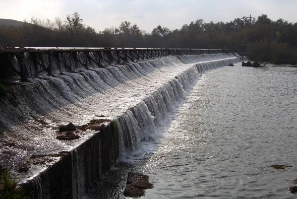
Photo by Adam Blauert
PG&E River’s Edge Fishing Access:This access point is 6.2 miles beyond Snelling, next to the PG&E hydroelectric plant. This access point allows you to fish above the spillway of the Merced Falls Dam. Note that swimming, float tubes, and boats are not allowed because of the proximity to the dam.
Hornitos Road Bridge Area:After Merced Falls Road turns sharply north, make a right turn on Hornitos Road. Turn again when the road splits for Lakes McSwain and McClure (left) and Hornitos Road (right). There are a number of places to park near the bridge. This area is 6.4 miles from 3rd and Highway 59 in Snelling. This is a popular place to fish from the shore or to launch float tubes or canoes.

Photo by Adam Blauert
PG&E Lake McClure Road Access:7.2 miles east of Snelling on Lake McClure Road, a right hand turn just before you reach the entrance gate to Lake McSwain and Lake McClure Recreation Area leads to another PG&E access point directly below the Lake McSwain Dam.

Photo by Adam Blauert
Mariposa County Access:
Beyond the McClure Road access point, the river is a part of Lakes McSwain and McClure. It becomes a free-flowing river again at the eastern end of Lake McClure where it is crossed by the Highway 49 Bridge.There is no road along the next 8.4 miles of the river.A very rough trail follows it (washed out on the Highway 49 side) but you can follow it cross-country on the northern side of the river until it becomes a true trail again.The eastern side of the trail is accessed from the end of the Briceburg Road.
There is no bridge across the confluence of the North Fork of the Merced, which can only be waded safely in low water conditions.The Briceburg Road follows the next 5 miles of the river beyond the trail up to where it joins Highway 140.From that point onwards, Highway 140 parallels the river closely into Yosemite National Park.
There are many views of the river from the road and many places to fish.Floating the river above Lake McClure is not recommended as there are many dangerous class III-IV rapids and a small waterfall near the confluence of the North Fork.
Rafting services
Several whitewater rafting companies offer guided trips to this area:
ARTA:Merced/Tuolumne - http://www.arta.org// (209) 962-7873
All-Outdoors California Whitewater:Merced/Tuolumne/Stanislaus/Cherry Creek - http://www.aorafting.com// (800) 247-2387
O.A.R.S.:Merced/Stanislaus/Tuolumne - http://www.oars.com/california/ (800) 346-6277
Whitewater Voyages:Merced/Tuolumne - http://www.whitewatervoyages.com/(800) 400-7238
Zephyr Whitewater:Merced/Tuolumne - http://www.zrafting.com/
From the end of the road in Yosemite, trails follow the river past Vernal and Nevada Falls to its sources in the wilderness of the park.
Avoiding Trespassing:The safest spots for legal river access in Merced County are Hatfield, McConnell, Henderson, and the access points maintained by MID and PG&E. The others are privately owned, but have not been posted or fenced in the past (this is always subject to change). This seems to indicate that the landowner is allowing access, however you may risk trespassing if you access the river at these points.
Taking Care of the River: Unfortunately, several of these access points have been trashed by previous users. Despite the work of volunteers to clean up the garbage, the problem continues. If the situation doesn’t improve, more access points may close or be posted “No Trespassing.”
Make sure you pack out your garbage and do anything you can to help keep these areas clean.

Photo by Adam Blauert
Fishing Regulations:Make sure you check fishing regulations for the area in which you plan to fish:http://www.dfg.ca.gov/. They change at the Crocker Huffman Dam.Although they are usually posted at the areas between the dam and the Highway 59 Bridge, conditions are always subject to change and may not be posted.
Other fishing and boating resources:
Fishing and Boating Resources at http://www.takemefishing.org/
Department of Fish and Wildlife Regulations: https://www.wildlife.ca.gov/
Department of Boating and Waterways Regulations: http://www.dbw.ca.gov/
Reservations for State, Federal, and Army Corps of Engineers Campgrounds: http://www.reserveamerica.com
The goal of this page is to provide useful and accurate information about river access. If you find something that is inaccurate or discover that conditions have changed, please inform the author atadamblauert@yahoo.com
Adam Blauert, a high school teacher and avid outdoors enthusiast, has dedicated the majority of his life to Merced County. His passions include fishing, backpacking, delving into local history, and exploring the wonders of the western states.