
Stanislaus National Forest

Stanislaus National Forest
Merced County is adjacent to two national forests. Flowing westward through the county, the Merced River forms the dividing line between Stanislaus National Forest and Sierra National Forest. Directly in the middle of the two forests is Yosemite National Park, the ultimate source of the river.
With the Merced River as a southern boundary, Yosemite National Park and the crest of the Sierra as an eastern boundary, the Calaveras/Amador County line as a northern boundary, and a rather erratic line through the foothills and lower pines as a western boundary, Stanislaus National Forest offers 898,099 acres for a wide variety of recreational activities.
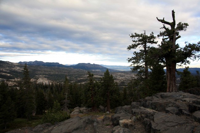
It is a land that stretches from dense forests of tall pines and firs to sharp granite peaks; a land of meadows, lakes, rivers, wildlife, and wildflowers. In the winter, heavy snow transforms it into a great place for skiing, snowboarding, snowshoeing, snowmobiling, playing in the snow, and enjoying beauty and solitude.
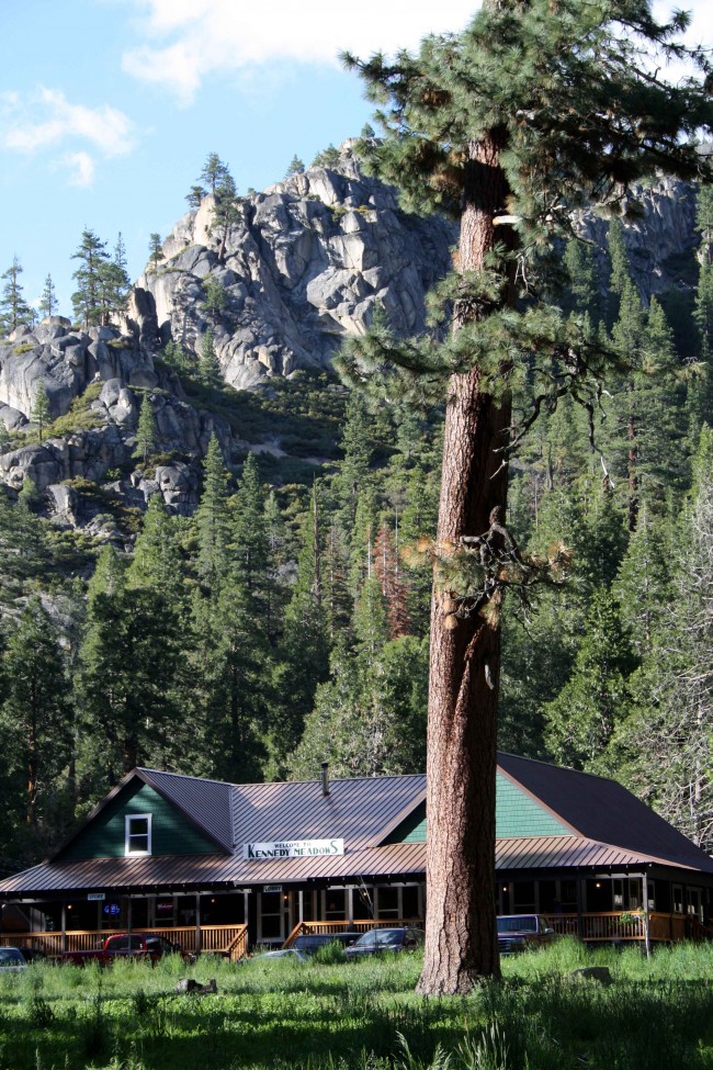
Photo by adam blauert Kennedy Meadows
Because the area is so diverse and offers so many recreational opportunities, there is often no clear answer to the question “What do you do there?” This article is an effort to answer that question and to provide a list of useful resources for learning about the forest and its recreational opportunities.
One of the best resources to start with is the annual visitor guide produced by Stanislaus National Forest is
Popular recreational activities within Stanislaus National Forest include
Auto touring
Visiting historic towns
Hiking and backpacking in wilderness areas
Hiking trails outside of wilderness areas
Camping
Ranger-led activities
Fishing
Boating
Swimming
Hiking and camping with dogs
Horseback riding
Mountain biking
OHV riding and exploring 4-wheel drive roads
Hunting
Downhill skiing
Playing in the snow
Cross-country skiing and snowshoeing
Snowmobiling

Stanislaus River photo by adam blauert
Within the forest there are many privately owned areas. Some of these offer additional recreational opportunities plus tent and RV campgrounds, lodging, restaurants, stores, and gas stations.
Ranger Stations
The Stanislaus National Forest Headquarters is located at 19777 Greenley Road in Sonora.
You can get general forest information and recreation permits by contacting the headquarters. The phone number is (209) 532-3671 and the general website for the entire forest is www.fs.usda.gov/stanislaus/.
The forest is divided into four districts which can provide more specific information about their respective areas:
Groveland District: 24545 Highway 120, Groveland – (209) 962-7825
Mi-Wok District: 24695 Highway 108, Mi-Wuk Village - (209) 586-3234
Summit District: #1 Pinecrest Lake Road, Pinecrest – (209) 965-3434
Calaveras District: 5519 Highway 4, Hathaway Pines – (209) 795-1381

Highway 108
Road Access and Auto Touring
Stanislaus National Forest is crossed west to east by Highways 120, 108, and 4. Anumber of secondary roads ranging from two-lane paved roads to rough four-wheel drive roads crisscross the forest. The major highways are worth driving simply to enjoy the views.
Major Towns, Supplies, Lodging, Food, and Gas
The major supply and service locations are adjacent to the major roads. Most of these towns have historic roots dating back to the 1800’s and are worth a visit in their own right. Especially historic and charming are Groveland, Jamestown, Sonora, Columbia, Twain Harte, Angels Camp, and Murphys.
Each of the major routes has chambers of commerce and/or business associations with websites for information about lodging, food, supplies, gas, local activities, and special events. I’ve listed them below in order from south to north:
Highway 120 ~ Big Oak Flat, Groveland, Buck Meadows, Mather
Highways 108 and 49 ~ Jamestown, Sonora, Columbia, Twain Harte, Mi-Wuk Village, Long Barn, Pinecrest, Strawberry, Dardanelle, Kennedy Meadows
Highway 4 photo by adam blauert
Highway 4 ~ Angels Camp, Murphys, Arnold, Bear Valley
www.ebbettspassadventures.com/
Wilderness Areas
Three wilderness areas are within or partly within the boundaries of Stanislaus National Forest. They offer some of California’s best hiking, backpacking, and fishing.
They are also great places to enjoy abundant and brilliant wildflowers and to see a variety of wildlife in its natural habitat.

Emigrant Wilderness Pack Trip photo by adam blauert
Emigrant Wilderness
The most popular wilderness area within the forest, the Emigrant Wilderness is adjacent to the northwest boundary of Yosemite National Park. Much of its popularity is the result of the terrain being somewhat less challenging than the steeper southern Sierra Nevada.
A land of low granite ridges with beautiful meadows and lakes, it is much like the northwestern part of the Yosemite Wilderness.

Columns of the Giants photo by adam blauert
Many remnants of volcanic activity can be seen, especially in the northeastern section. Although there are plenty of easier trails, you can also find many challenging routes that will take you far from any road.
The wilderness has a long human history and many of the lakes have been enlarged by small “check dams” that ensure a lasting water supply for grazing cattle through the summer.
Many of the meadows have been used as summer pasture since the 1800’s. Cattle are still often seen and remain a part of the living history of the area.
The lakes and streams provide some of the best fishing in the northern Sierra Nevada. There are several short backpacking and hiking destinations accessible from the western edge of the wilderness, but some of the most impressive destinations require trips of four days or more.
For more information go to: www.fs.usda.gov/recarea/stanislaus/recreation/recarea/?recid=15107
Carson-Iceberg Wilderness
Named for explorer Kit Carson who pioneered a trail through the area and for the Iceberg, a granite landmark located near the southern boundary of the wilderness, the western part is managed by Stanislaus National Forest and the eastern part by Humboldt-Toiyabe National Forest.
The Pacific Crest Trail traverses the eastern section. The terrain is rugged and steep, with fewer lakes than the Emigrant Wilderness. For these reasons this area sees fewer visitors, but provides excellent and challenging trails and options to find true solitude.
This is a great place to see remnants of the volcanic activity that shaped our state’s landscape.
For more information go to: www.fs.usda.gov/recarea/stanislaus/recreation/recarea/?recid=15109
Mokelumne Wilderness
Split among the Stanislaus, El Dorado, and Humboldt-Toiyabe National Forests, this area’s landscape is much like Carson-Iceberg.
Rugged, steep, volcanic, and without many lakes, it is still a place of great beauty where solitude may be found despite its proximity to Lake Tahoe. Located north of the Carson-Iceberg Wilderness, a long section of the 2,600 mile Pacific Crest Trail also passes through this area.
For more information go to: www.fs.usda.gov/recarea/ltbmu/recarea/?recid=11788.
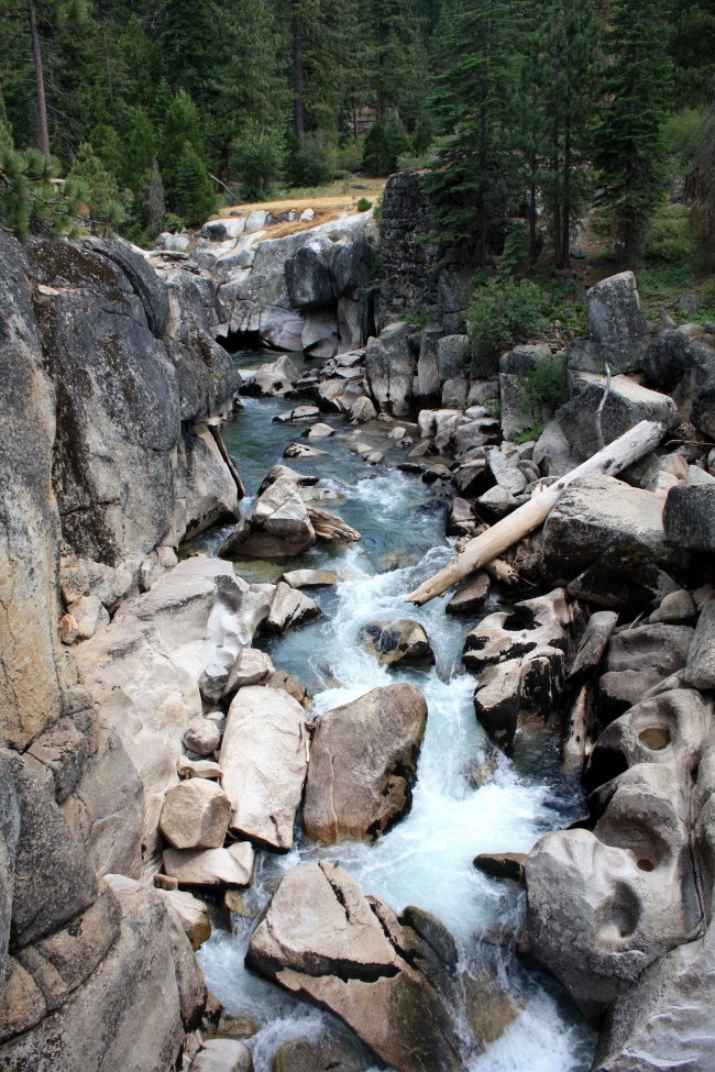
Stanislaus River photo by adam blauert
Trails Outside of Wilderness Areas
A number of excellent trails are found outside of the wilderness areas. Details can be found in some of the books listed below. You can also read some short descriptions at this site: www.fs.usda.gov/activity/stanislaus/recreation/hiking/?recid=14833&actid=50.
Books, Maps, and Other Resources
Although web-based resources are great for planning a trip, cellular service, internet, and electric power are hard to come by in much of the forest.
If you can store electronic resources on your device and have well-charged batteries, you may be able to continue to access your information this way. It’s always good, however, to have some paper resources. Print out information from the internet and bring both maps and books.
The general guide produced by Stanislaus National Forest is invaluable to have with you, especially if your plans change while on a trip. Weather and other elements outside of your control often require flexibility.
Books
Unfortunately there is no single book that comprehensively covers this area. For backpacking, Sierra North from Wilderness Press is a great choice.
For shorter day hikes, pick up a copy of California Hiking by Stienstra and Brown. Not only does this book highlight the best day hikes in Stanislaus National Forest, it is also an excellent resource for the entire state with a total of 1,000 hike routes.
Emigrant Wilderness published by Tom Harrison Maps Carson-Iceberg, Emigrant, and Mokelumne Wilderness Areas published by National Geographic The Forest Service also publishes separate maps for each wilderness area For more detailed hiking maps, check the USGS website for 7.5 and 15 minute sections. You can order printed copies of these maps or download free electronic copies.
Maps
It’s good to have a general highway map, but if you plan to explore off the main roads the Stanislaus National Forest Map is one of the most important things to have with you. In addition to roads and trails, it also shows campgrounds, ranger stations, supply locations, and recreation areas. It supplements the general guide to the forest (see above).
For some reason it is hard to find on the internet. Your best source is the website of the U.S. Geological Survey where you can buy it for $12: store.usgs.gov.
You can also purchase it at a ranger station.
For hiking or backpacking, the following maps are the top choices:No matter what resources you use, always call a ranger station to verify current conditions before you leave on a trip.
Conditions are always changing and even the official websites can be badly out of date.
Campground Camping
Within Stanislaus National Forest you’ll find 47 campgrounds.
You can also find a complete listing at: www.fs.usda.gov/activity/stanislaus/recreation/camping-cabins/?recid=14833&actid=29.
Some campgrounds are reservable in advance. You can search for reservable campsites by going to: www.recreation.gov.
Dispersed Camping
Camping outside a campground (usually referred to as “dispersed camping”) is permitted in areas of the forest where signs do not specifically prohibit it.
You can always check with a ranger station before you set up camp. In order to have a campfire you need a California Campfire Permit, available at any ranger station. You can also take an online quiz and get one issued electronically by going to: www.fs.fed.us/r5/sequoia/passespermits/campfire_permit/campfire-index.html.
As long as you follow the rules on the permit and make sure that you have chosen a safe site, your campfire is legal. Before your trip you should also make sure that additional campfire restrictions have not been put in place.
In dry years campfires are sometimes prohibited outside of established campgrounds.
Ranger-Led Activities
A variety of programs and hikes for all ages and ability levels are offered throughout the year. You can find up-to-schedules for each ranger district at: http://www.3forests.us/stanislaus.
Fishing: The forest abounds with streams, rivers, natural lakes, and reservoirs. Many are stocked and most are open to fishing. For regulations and stocking information, go to www.dfg.ca.gov.
Tom Stienstra’s California Fishing is a good general guide to the whole state, including Stanislaus National Forest.
Boating: Motorized fishing boats area allowed on the following lakes: Alpine, Beardsley, Cherry, Pinecrest, Spicer (in the half of the lake within Tuolumne County, but not in the Alpine County half), and Union. Water skiing and jet skis are allowed at Beardsley and Cherry.
Swimming: Swimming is allowed in most streams, rivers, and lakes, however it can be dangerous. Make sure that all people in your group have strong swimming abilities and you have flotation devices in case a rescue is necessary. Check with a ranger for current conditions. Generally Pinecrest Lake is one of the safest easily-accessible swimming destinations. Cherry Lake is also a good choice.
Dogs
Dogs are welcome on trails and in campgrounds in national forests as long as they are on-leash and well-behaved. They are not permitted on trails in state or national parks. Dogs may be off-leash as long as they are under voice control within wilderness areas (except in the Carson Pass Management Area of the Mokelumne Wilderness).
Horses
Horses are permitted on trails within the national forest. For overnight trips they must be included on your wilderness permit. Check with the ranger station for the best trail parking for horse trailers. Day rides and overnight pack trips are offered by:
Kennedy Meadows Pack Station: www.kennedymeadows.com/
Aspen Meadow Pack Station: aspenmeadowpackstation.com/
Leavitt Meadows Pack Station: www.leavittmeadows.com/
If you are not up to carrying all your gear or if you want to enjoy the wilderness with in a less strenuous way, a pack trip is a good choice.
Mountain Bikes
All roads and most trails outside of wilderness areas are open to mountain bikes. Check with a ranger for recommended trails and roads. Ann Marie Brown’s Northern California Biking is an excellent resource.
Off-Highway Vehicles and 4-Wheel Drive Vehicles
Many remote forest roads require 4-wheel drive and several areas are open to off-highway vehicles. For more information go to: www.fs.usda.gov/activity/stanislaus/recreation/ohv.
A copy of the Stanislaus National Forest map is extremely helpful in locating the best sites.
Hunting
The forest, including wilderness areas, is open to hunting according to DFG regulations. You can check regulations at www.dfg.ca.gov. Target shooting is prohibited in wilderness areas.
Winter Activities
Some roads and campgrounds are open through the winter months, especially in the lower elevations. Always carry tire chains and know how to install them. Highway 4 closes at the Bear Valley road junction and Highway 108 closes beyond Strawberry after the first major snowfall. Many lodging facilities are open year-round.
Downhill skiing and snowboarding
Offered at Dodge Ridge (Highway 108 at Pinecrest), and Bear Valley (Highway 4 near Lake Alpine). For more information:Snow Play Areas: Stanislaus National Forest is also a popular destination to play in the snow. Three “Sno-Parks” offer snow recreation for a $5 use fee.
You can find more information at: www.ohv.parks.ca.gov/pages/1233/files/sno-parks_2008-09.pdf.
Permits must be purchased before you reach the Sno-Park. Look for signs as you drive up Highway 108 or Highway 4 or call the ranger station for a current listing.
Snowshoeing and cross-country skiing
Along trails is also popular. Occasionally ranger-led snow activities are offered. Check with the ranger station for details. If none are offered, try Yosemite or Sequoia National Parks.
To find your own route, pick up a copy of Best Snowshoe Trails of California by Mark White. www.dodgeridge.com/sitewww.bearvalley.com
Snowmobile Trails
For snowmobiling information go to www.fs.usda.gov/activity/stanislaus/recreation/wintersports/?recid=14833&actid=92 or call the ranger station.
Adam Blauert, a high school teacher and avid outdoors enthusiast, has dedicated the majority of his life to Merced County. His passions include fishing, backpacking, delving into local history, and exploring the wonders of the western states.